
Last Updated on 4 weeks ago by TodayWhy Editorial
Updated: The sun is not on fire. In most of the country, neither is the sky.
If you typed why is the sun red today in 2026, do not assume you are standing in last July’s plume. That event — Pacific Northwest and Canadian smoke drifting across the Lower 48, a deep-red disk even at noon — is over. Current snapshots from the smoke-monitor network showed the bulk of U.S. stations in the Good range, a smaller set Moderate, and none above Moderate at the last national roll-up. Isolated fires in Idaho, western Montana and California were still putting up local plumes. They are not painting the East Coast.
The short physics does not change. The long weather story does. A red sun means the air between you and the disk has stripped out the blue. What stripped it on this Sunday depends on where you are standing.
Why is the sun red today? The short answer
Sunlight looks white, but it is a mix of every colour. When that light passes through clean air, the shorter blue wavelengths get scattered in every direction, which is what paints the daytime sky blue. The longer red and orange wavelengths mostly travel straight through to your eye.
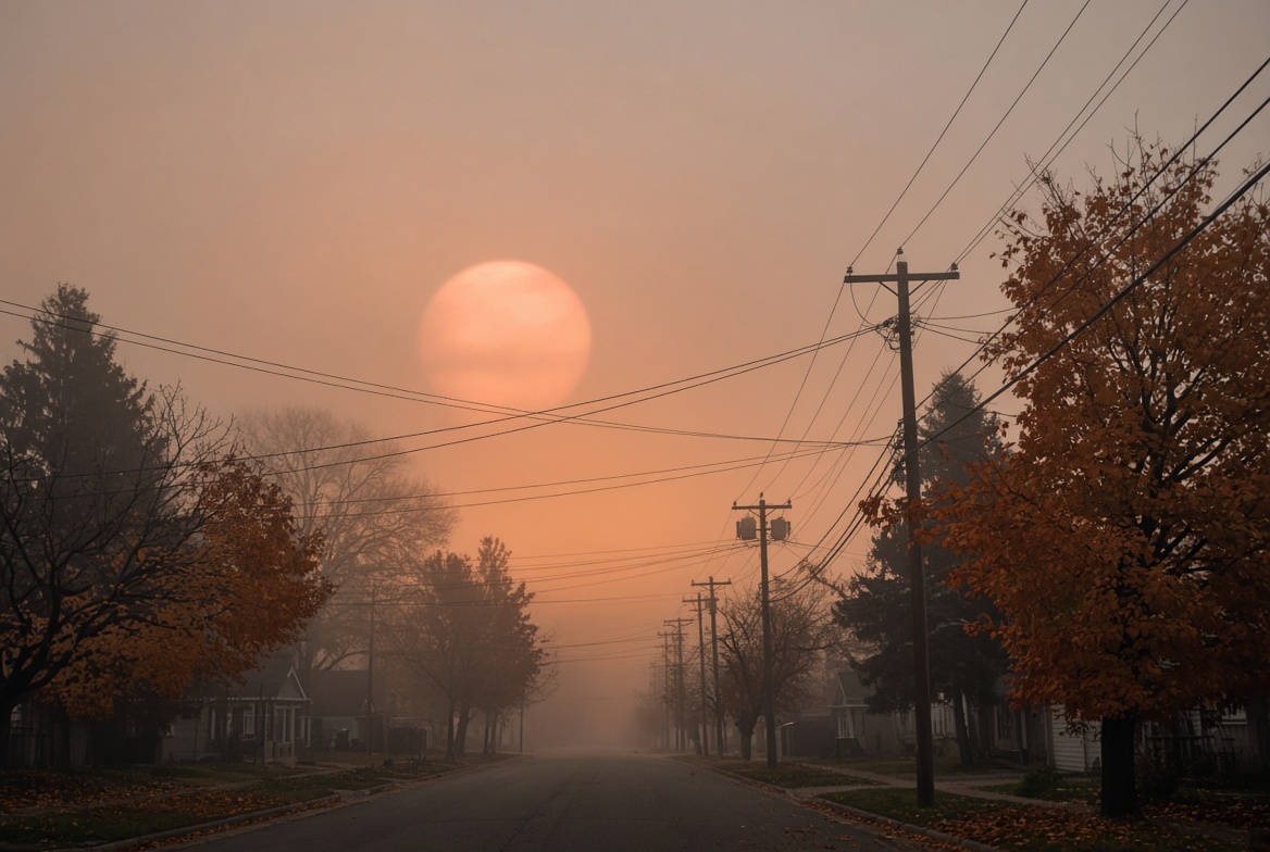
Add a thick layer of tiny particles — smoke, dust, or the extra air you look through at sunset — and the blue light gets scattered away even more aggressively before it reaches you. What is left of the sun’s light is the red and orange end of the spectrum. The disc itself turns red, the sky loses its blue, and everything takes on a strange amber cast. So a red sun is not the sun changing. It is the air changing what the sun’s light does on the way in.
The physics in one paragraph
Sunlight is white: every visible wavelength mixed. Air molecules scatter short wavelengths (blue, violet) far more than long ones (orange, red). That is Rayleigh scattering, and it is why a clean noon sky is blue while the disk looks near-white. Put the sun on the horizon and the beam crosses tens of times more air. Blue is gone before it reaches you. Put smoke, dust or smog in the column and the same filter works at midday. The disk is still the same star. The filter changed.
Wildfire smoke is especially good at this. The particles are the right size to knock out blue while leaving a copper disk you can look at longer than you should. Do not. A dim red sun is still bright enough to damage an eye. Smoke is a filter, not welding glass.
What is not happening today
Mid-July 2026 trained the internet to treat every red sun as “the fires.” NASA even picked a British Columbia smoke-disk as Astronomy Picture of the Day on 30 July. That mental shortcut is stale on 27 September. National AQI maps are mostly green. The East Coast’s live weather story is a lingering nor’easter — rain, onshore wind, coastal flooding — which makes grey and white skies, not a nationwide amber lid.
If your sky is yellow-orange rather than the disk alone going red, read the companion explainer: why is the sky yellow today. The disk and the bowl of the sky are two different optical paths.
How to tell smoke from sunset from storm
- Sunset only, blue sky overhead: geometry. Normal.
- Disk red at noon, sky milky, faint woodsmoke smell: particles. Check AirNow or the Fire and Smoke Map for your ZIP.
- Disk faint behind a flat grey deck, rain in the forecast: cloud, not smoke. That is the Northeast this weekend.
- Cars dusted with a fine tan film: dust, sometimes Saharan, more often local soil on a windy day.
AQI 0–50 is Good. 51–100 Moderate — sensitive groups may notice it. 101–150 Unhealthy for Sensitive Groups. If the map is green and the sun is still red, look at the clock before you look at a fire map.
Wildfire smoke, Saharan dust, or just a sunset?
Three everyday causes account for the overwhelming majority of red-sun sightings, and it is worth knowing which one you are looking at.
Wildfire smoke is the usual suspect in summer and autumn. It produces a wide, milky haze that can cover a whole sky for days, often with a faint smell and a sun that stays coppery even when it is high overhead. Saharan dust is the other big long-distance traveller: plumes of desert dust regularly drift north over Europe, muting the sky, coating cars in a fine film, and turning the sun a pale yellow-orange. A plain sunset needs no pollution at all — it is simply the sun’s light travelling sideways through the thickest slice of atmosphere, which is why sunsets redden even on the cleanest days.
Does a red sun mean the air is dangerous to breathe?
Not automatically. A red or orange sun tells you there are particles in the air, but not how high up they are — and altitude is what decides the health risk. When wildfire smoke rides high in the atmosphere, it can make for spectacular skies while ground-level air stays in the fair-to-moderate range. The danger rises when smoke descends to where you actually breathe, which is when official air-quality alerts are issued.
The practical rule: judge the air by the air-quality index for your exact location, not by how alarming the sun looks. A dramatic sky is a cue to check, not a diagnosis on its own. Anyone with asthma, heart or lung conditions, or who is very young or elderly should treat a smoky day with extra caution and follow local guidance on limiting time outdoors. For a fuller breakdown of the current air-quality picture city by city, see our companion page on why the sky is yellow today.
Why the moon looks red or orange too
The same smoke and dust that redden the sun also tint the moon. On a smoky night the moon can rise a deep orange or blood-red for exactly the reason described above: blue light is scattered away, red light gets through. This is different from a total lunar eclipse, where the moon turns red because it passes into Earth’s shadow and is lit only by the sunrise-and-sunset light bending around the planet. Both look red; the causes are not the same.
How to check what is causing it where you are
Because the source of the smoke shifts from week to week, the most reliable answer for your specific location comes from real-time tools rather than a fixed list of active fires. The AirNow Fire and Smoke Map overlays current fire locations with live smoke plume forecasts and air-quality readings for your exact area, and is the fastest way to see whether today’s red sun traces back to a nearby fire or one hundreds of miles upwind. Beyond that, three checks answer it quickly: look at your local air-quality index for a spike in fine-particle pollution, which points to smoke or dust; check your national weather service or meteorological agency, which will usually flag active smoke or dust transport in the forecast; and scan local news, because a nearby wildfire, controlled burn, or dust event is often the plain answer that a national map will miss.
This particular episode fits a pattern that is becoming more familiar as fire seasons lengthen. It connects directly to the wider story of a hotter, drier climate driving more intense fires — the same forces behind Spain’s fast-moving wildfires and the extreme European heatwave that primed so much of the continent to burn.
Frequently asked questions
Why is the sun red today in September 2026?
Most places: low autumn sun or thin local haze. A few Western valleys: leftover or active wildfire smoke. Not the July nationwide plume.
Is it safe to look at a red sun?
No. Dimming is not protection. Use proper solar filters if you want to stare. The rest of us glance and look away.
Does a red sun mean the air is dangerous?
Only if the AQI says so. A red sunset over a Good AQI county is optics. A red noon sun over an Unhealthy county is smoke you should not jog in.
Why did the sun look redder on Friday night in the Northeast?
The nor’easter’s high ice-crystal cirrus caught the setting beam. That is a cloud sunset, not a smoke sunset.
Fazit
Why is the sun red today? Because the air between you and a white star is acting like a filter. In 2026 that filter, for most Americans, is the long autumn slant or a local haze — not the mid-summer smoke river this URL still ranks for. Update the mental model with the date. Then check AirNow before you cancel the walk.